By STEVE JACKSON FOR DAILY MAIL AUSTRALIA
Published: | Updated:
Cyclone Alfred has been downgraded to a tropical low, with 55km/h winds near the centre, and gusts of up to 85km/h.
As of 6am, the ex-tropical cyclone was 65km north of Brisbane and 40km south of Maroochydore. It is expected to cross the mainland this morning, with winds weakening as it moves inland.
Authorities are warning heavy rainfall is still likely to continue over southeast Queensland and northern NSW during the weekend.
Disaster relief payments for Aussies
Anthony Albanese announced on Saturday disaster relief payments would be made available to Australians caught in the firing line of ex-Tropical Cyclone Alfred.
‘We stand ready to activate disaster payments,’ he said.
‘We won’t be waiting for the March 2025 Budget to do that. We will do so expeditiously as it appropriate.
‘The Australian Government Disaster Recovery Payment is a one-off payment of $1,000 per adult and $400 for a child, for people who have been badly affected by the disaster and need immediate help.
‘That is activated 40 hours after the initial impact. The Disaster Recovery Allowance is a payment for up to 13 weeks for people who are unable to work as a direct result of the disaster.’
He added: ‘There are also jointly funded payments between the Commonwealth and the state, so they are activated by the states.
‘There is a personal hardship assistance scheme. States can choose to activate these payments which cover immediate personal costs like replacing food, medical supplies, clothing, and essential household items like bed linen and whitegoods.
‘That is activated by the states.’
The cyclone that never was: Aussies poke fun at ‘worst weather disaster in 50 years’
After days of booming disaster warnings, millions of anxious residents woke this morning to the news the much-hyped Tropical Cyclone Alfred lurking off Australia’s east coast wasn’t the category two behemoth it has been built up to be.
Or even technically a cyclone anymore.
The slow-moving system, which is still lingering off the coast near Bridie Island and is not expected to thunder onto the mainland for another hour or two, has been downgraded to a tropical low.
The Bureau of Meteorology is urging people to refrain from celebrating just yet, insisting the storm will still wreak havoc across south-east Queensland and northern NSW.
‘Now, just as a reminder to everyone, the category of tropical cyclone is based on the wind strength and wind gust speed,’ Bureau meteorologist Miriam Bradbury says.
‘That means we’ve seen those winds backing off over the last few hours, leading to that weakening in the system.
‘However, it doesn’t speak to the rain and flooding risk that we’re still anticipating.
‘The system is no longer a tropical cyclone, but significant, severe weather warnings and flood warnings remain in place, flagging that risk of heavy rainfall, flash flooding and riverine flooding through the rest of today and going into tomorrow.’
Still, the warnings have done little to stem the backlash against the Bureau on social media for ‘crying wolf’ and over-selling the threat posed by the tempest throughout the week.
And now the memes and videos poking fun at the Bureau are starting to flood in too.
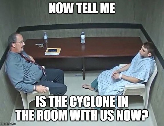
One post shows two men in a police interrogation cell, along with the question ‘Is the cyclone in the room with us now?’
While another praises brave Queenslanders’ determination to ‘rebuild’ in the wake of the carnage caused by the storm by fixing up a blown over deck chair.
Another not-so-bemused resident has posted a comic video highlighting the ‘terrifying’ damage the cyclone caused in his backyard.


Alfred downgraded to tropical low – but destructive flood threat remains
Authorities are warning residents to brace for devastating floods despite Cyclone Alfred being downgraded to a tropical low.
The Bureau of Meteorology says the category rating system only relates to wind speeds, and has nothing to do with the amount of rain that will be dumped across the impact zone in the coming days.
‘In this case, Alfred is going to bring a lot of rain, whether it is a tropical cyclone or whether it is a tropical low,’ the Bureau’s Angus Hines tells the ABC.
‘Tomorrow, it will be inland areas which start seeing severe falls and so the hinterland, the Scenic Rim, parts of (the) Darling Downs and Queensland, and then parts of the Northern Tablelands.’
He also predicts regions south of the eye of the storm will be hardest hit by the storm and its torrential downpours.
His warning comes amid fears the Wilsons River will break its levee in South Lismore in the next couple of hours amid widespread flooding throughout northern NSW.
Lismore Mayor Steve Krieg says it is distressing news for a community still trying to rebuild in the wake of the devastating 2022 floods.
‘If our levee overtops especially, our town’s in a lot of trouble – just emotionally, financially, people are really struggling before this cyclone,’ he says.

Dramatic rescue as dozens flee wind-damaged apartment block in dead of night
Almost two dozen people were forced to make an emergency evacuation from an apartment complex on the Gold Coast in the dead of the night as the city was hammered by fierce winds.
Acting Queensland Police Commissioner Shane Chelepy says officers were called out to almost 90 disaster-related jobs overnight, while the SES responded to an additional 77 incidents.
So far there has been no loss of life or missing persons reports as a result of the thundering weather system.
‘Which is frankly terrific at this stage,’ he says.
‘We did see an apartment complex on Labrador on the Gold Coast suffer damage.
‘Twenty-one people were safely evacuated from that apartment complex and are now in our evacuation centres, with one lady suffering minor injuries, but she is in good health.’
He says there were no reports of ‘significant’ property damage as the storm rolled over Stradbroke Island and Moreton Island.
‘There are communication outages, particularly in the Gold Coast hinterland area,’ he says.
‘Most of those communication outages are related to power and we will see majority of them come back on as the power gets restored in those areas.’
Mr Chelepy also urges people in flood-affected areas to remain vigilant and be ready to leave if water levels continue to rise.
‘Yesterday the emergency services continued to doorknock over 2,000 homes at our flood-risk areas — flood maps for these areas are available on the council dashboards, so can I ask you to familiarise yourself with those areas,’ he says.
‘Don’t wait for the police to knock on your door.’
Queensland premier warns of ‘race against the clock’ as storm settles over impact zone
Queensland Premier David Crisafulli warns heavy deluges and severe flooding remain the greatest threats as ex-Tropical Cyclone Alfred unleashes a torrential downpour on the state’s southeast.
‘The challenges now are flash flooding, creek rises. They remain a real prospect with some of the rainfall predicted in the days ahead,’ Mr Crisafulli says.
‘We have to be ready for that prospect. With swollen catchments, the risk of flash flooding remains, I’m asking Queenslanders to continue to stay vigilant.
‘Just to give you an indication of what occurred in the past 19 hours, we’ve had 240 millimetres recorded at Springbrook, 200 millimetres at Tallebudgera and 100 millimetres at Mount Cotton.’
Mr Crisafulli adds that while there had been some significant property damage overnight, the region had been spared the worst ravages with the tropical system weakening substantially this morning before reaching the mainland.
‘We’ve had quite a few instances of trees falling on homes, cars and powerlines.’
He says almost 250,000 homes remain without power across the storm’s impact zone and that more 2,000 emergency personnel are in position and ready to make urgent repairs as soon as conditions ease.
‘This is the single biggest loss (in power) we have seen in over a decade since (cyclone) Oswald,’ he says.
‘Queenslanders need to know know that right now there are damage assessments being done and already crews are being mobilised to get that job done.
‘A quarter of a million homes without power is a massive task, but it is a massive task that they are up to.’
Several key services have also loss connection to the power grid and are running on generators, he says, including the Gold Coast University Hospital and water treatment plants in Alexandra Hills and Mount Cotton.
‘There are generators on site and staff are urgently attempting to reconnect those, and it is a race against the clock to try to do that in the minutes and hours ahead before those reservoirs run out of water,’ he says.
Furious storm brewing on social media as tropical cyclone is downgraded to tropical low
There is already a storm brewing on social media with irked residents accusing the Bureau of Meteorology of overzealous fearmongering about the potential impact of now ex-Tropical Cyclone Alfred.
The agency spent much of the past week issuing dire warnings south-east Queensland and northern NSW would be devastated by the category two system – the first to hit the region in more than half a century – when it eventually made landfall.
But with the storm downgraded to a category one system overnight and again to a tropical low this morning, people are now unleashing their own fury online.
‘Cyclone Alfred is a tropical low. The BOM talked it up and scared people,’ one user says.
Another adds: ‘Meteorologists just joined politicians and journalists as the most untrustworthy, dishonest ponces in Australia.’
Some are frustrated by the time and expensive seemingly wasted preparing for a cyclone to hit.
‘All that work and money spent on preparation for some drizzle,’ one user says. ‘The mosquitoes are more dangerous than this supposed cat2/tropical low.’
‘So it’s a low…ffs,’ another use says before someone replies: ‘Haha of course but they shut the city down and public transport for that.’
Others mocked the Bureau for ‘crying wolf’ and described the fierce storm as ‘a fizzer’.
However, authorities have been quick to point out that while the country has been spared the full wrath of a destructive cyclone, the category system only relates to a storm’s wind speeds, and the impact zone will still be inundated with damaging floods.

SES chief warns deluges and flooding will continue for days
NSW SES Deputy Commissioner Deb Platts is urging people to remain vigilant even though Cyclone Alfred has been downgraded to a tropical low, warning rain and floods will continue for days.
‘This is a very dynamic and widespread system,’ she said on the Today show.
‘We know that this system, because it’s such a large system, is going to keep up the winds and the rain for potentially up to three, four, five days.
‘The wind in particular, we know, is hitting parts of north-east NSW. We’re seeing debris flying around trees and power lines that are down.’
The SES has been called out to 26 flood rescues, mostly for people driving through floodwaters, in the past 24 hours alone and drivers are being urged to stay off the roads.
‘What we’re seeing now is the rivers start to rise and we will continually see that rising in most areas,’ she says.
‘How that impacts downstream is what is concerning us.’
Anthony Albanese slammed for Cyclone Alfred decision
Anthony Albanese has been slammed for revealing he will not call an election date this weekend due to ex-Tropical Cyclone Alfred.
Mr Albanese made the revelation on ABC’s 7.30 program on Friday, arguing he would not announce the election date on Saturday or Sunday while the government focused on the incoming cyclone.
The federal election was widely expected to be held on April 12, however it is now believed it will be held in May.
The tropical cyclone has since been downgraded to a tropical low.
Aussies took to social media platform X to slam the news, with many accusing Mr Albanese of using the storm to his political advantage.
‘Cyclone isn’t going to the last until April 12. Election must be held by May. Is a month really going to change much?’ one wrote.
‘Call the election! No excuses! We want time to test the candidates. We want debates on the issues. We want change,’ another added.
‘Delaying the inevitable bloodbath Labor will be experience,’ a third wrote.

Emergency workers inundated with pleas for help amid widespread flash flooding
Emergency crews have been inundated with calls for help as flash floods wreak havoc across large stretches of the country’s east coast.
The NSW SES says it has received more than 8,800 calls and responded to more than 5,062 incidents throughout the state’s north-east as Cyclone Alfred thunders towards the mainland.
As of 5am on Saturday, more than 16,000 residents have been evacuated across the region, with 31,000 homes subject to warnings as a result of severe flooding.
Millions bracing for impact with storm predicted to strike within hours
Millions of residents across south-east Queensland and northern NSW are bracing for ex-Tropical Cyclone Alfred to hit the mainland within hours.
The slow-moving storm has been on a collision course with the densely populated corridor for days and is predicted to finally strike this morning.
The system is currently about 40km off the Sunshine Coast, and 65km northeast of Brisbane, and is expected to make landfall between Maroochydore and Bribie Island this morning.
Although the cyclone has been downgraded overnight, it is still expected to batter the region with wind gusts of up to 85km/h.
Heavy rainfalls are now expected to be the most dangerous aspect of the storm, with major flooding predicted throughout the region.
Almost a quarter of a million homes are without power across south-east Queensland while close to 50,000 homes have lost electricity in northern NSW after the regions were lashed by storms ahead of the cyclone.
Authorities warn even more homes are likely to lose power when the full force of the storm hits today and that the blackouts could last days.
Public transport has been shut down throughout the impact zone, along with major supermarket chains and most businesses.
All planes have been grounded at Brisbane and Gold Coast airports and flights suspended for the duration of the storm, with Qantas predicting air travel will resume from Sunday morning.
More than a quarter of a million homes without power
Thousands of homes have been plunged into darkness overnight with almost 250,000 properties now without power in Queensland.
Close to 50,000 houses are also without electricity south of the border in northern NSW, with authorities warning the outages could last for days.
The Gold Coast has been the hardest hit by blackouts with almost 120,000 homes affected.
More homes are expected to lose power throughout the morning as storms continue to batter the coast and bring down power lines.
Cyclone Alfred hits Queensland’s outer islands
Tropical Cyclone Alfred has been downgraded to a category one system as it hits Queensland’s outer islands.
As of 4am, the cyclone was close to Bribie Island and moving 10km/h to the mainland with 65km/h winds near the centre and gusts of up to 95km/h.
It was 55km northeast of Brisbane and 55km southeast of Maroochydore, and is expected to make landfall in the next few hours.
As Alfred crosses the coast, it is forecast to weaken below tropical cyclone strength.
Despite its weakening, heavy rainfall, wind and high swells are likely to continue over southeast Queensland and northeast NSW during the weekend.
The warning zone has been reduced from 650km to 160km, and now stretches from Noosa to Brisbane, but doesn’t include the Queensland capital.


Share or comment on this article:
Cyclone Alfred live updates: what you need to know
Leave a Reply